Precision Planning Made Simple: WoodsApp's Polygon Drawing Tools
WoodsApp continues to evolve, introducing features that blur the line between professional-grade software and accessible technology for everyday users. One of the latest additions to the platform demonstrates this commitment: a geometry-drawing tool that brings precision planning directly to landowners and forest workers.
Polygon drawing capabilities have long been the domain of specialized GIS software and institutional forestry systems, tools reserved for professionals working within large organisations. WoodsApp has democratized this functionality, making advanced spatial planning available to any landowner managing their forest.
Professional tools for everyone
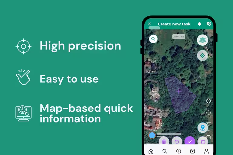
The feature is deceptively simple: draw a polygon on your map to identify and mark specific areas of interest. But this simplicity masks powerful functionality. Whether you're planning an inspection, coordinating the removal of a fallen tree, or marking a work zone, the polygon tool lets you define boundaries with high precision.
Drawing with flexibility
One of the tools' key strengths is its adaptability. The drawing interface allows you to refine even the smallest details of your polygon, adjusting corners and edges until the shape matches your needs. Combined with high-precision mapping, this means your planned work areas are accurately represented on the map, down to the details that matter.
Turning plans into action
Drawing a polygon is just the beginning. Once you've identified an area, you can immediately connect it to a task. Add all relevant details (what needs to be done, timeline, safety considerations) and assign it to the right team member. They'll receive a notification and can view the task directly on the map, seeing both the work description and the precise location where work needs to happen.
This workflow reduces friction in forest management. No more lengthy phone calls trying to describe a location. No more miscommunications about where work should take place. No more risk of errors born from imprecise instructions. By combining clear spatial communication with task management, WoodsApp helps teams work more efficiently and safely.
For landowners and forest workers alike, this means spending less time coordinating and more time doing the work that matters.
Built for precision
WoodsApp was developed by BitApps with a single guiding principle: to bring precision to forest management from the very start. The polygon drawing tool exemplifies this vision: professional capability, delivered simply, for everyone who depends on their forests.

